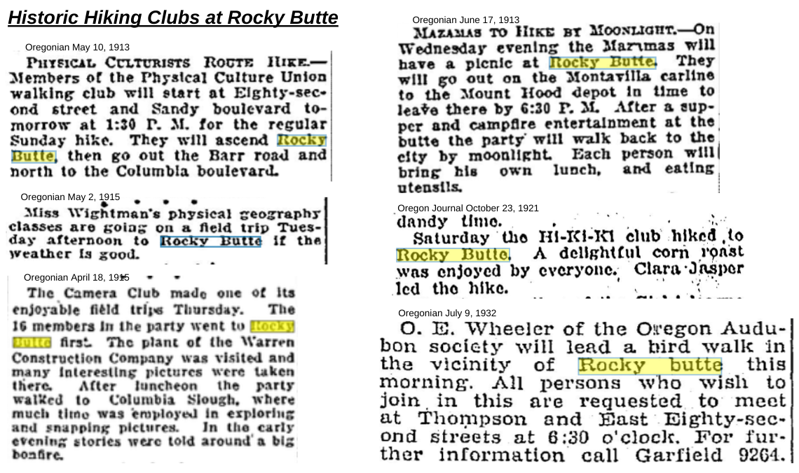
The Mazamas, Camera Clubs, Auduboners, Geography students, Physical Culturists and the Hi-Ki-Ki club all hiked Rocky Butte over hundred years ago. And even before that, the Chinook Speaking-band of the Cascade/Watlala people hiked and hunted deer around the Butte. Back then, it looked very different and the landscape was mostly undeveloped. Nowadays, even though the Butte is urban and developed, people are still braving the slopes. It’s the view. It’s the super steep gradient. It’s the trees and wilderness. People have always been drawn to this little volcano. It is a satisfying place to get to and to be at, whether you are alone or with others.
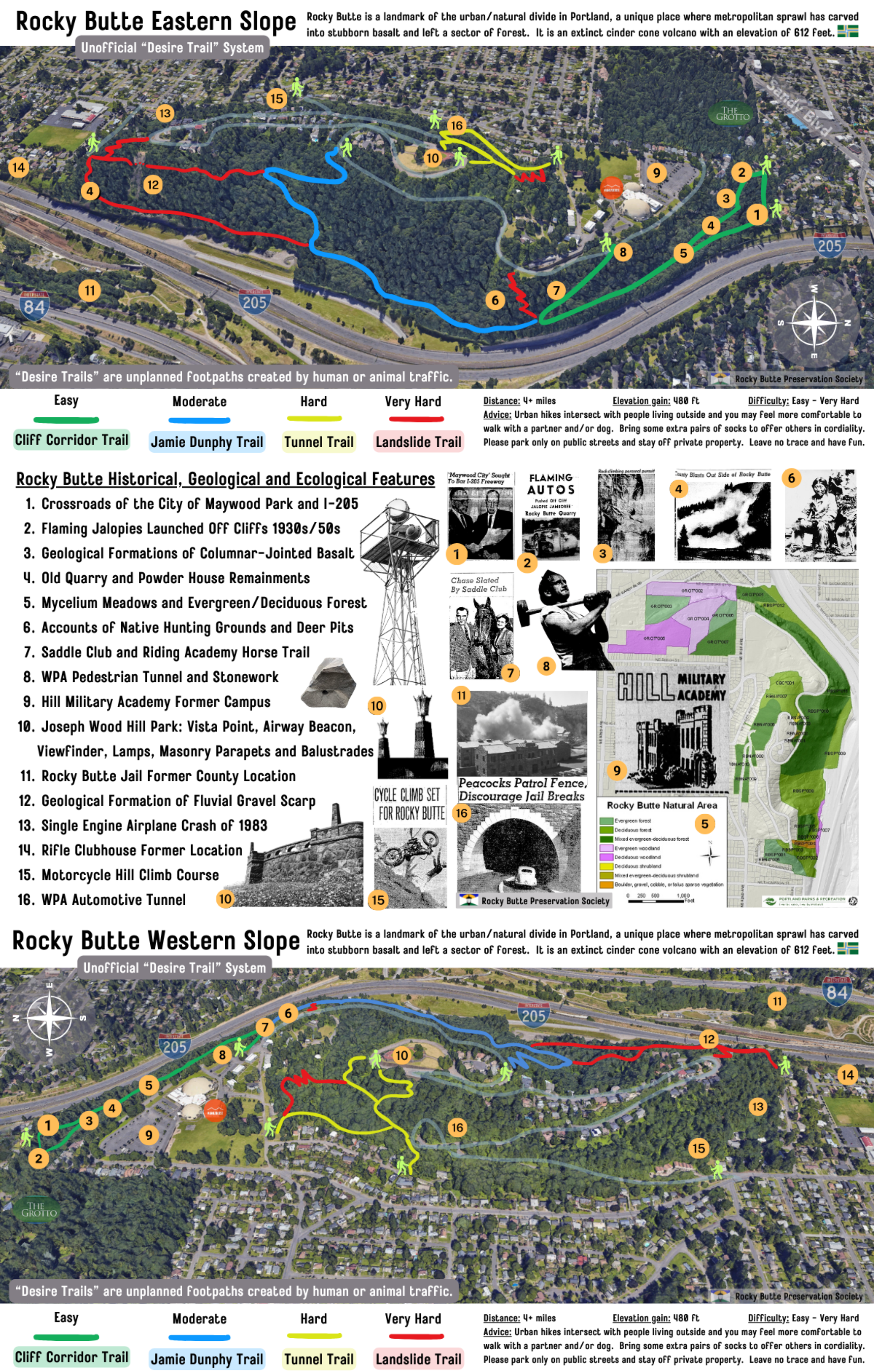
Many of the historical features around Rocky Butte are accessible by hiking along current “Desire Trails”, unplanned paths that were developed over time by people and animals. However, these paths are unofficial and unmaintained, which makes it difficult to visit some of the historical spots. Recreation can be a method of preservation, and establishing better access to the Butte’s history is an important factor in the overall stewardship of the area. Currently, we are re-envisioning ways to increase access to these historical places and more responsibly maintain the land. This conceptual hiking map could be a start. The place is challenging, because being squeezed between I-205 makes the area a type of dead-end zone and prone to many unseen and anonymous types of activities that are not recreational. To better utilize this area some neighbors have suggested putting in bicycling trails, a disc golf course, place making signs/interpretive boards and even developing residential structures. What are your ideas?

Leave a comment